
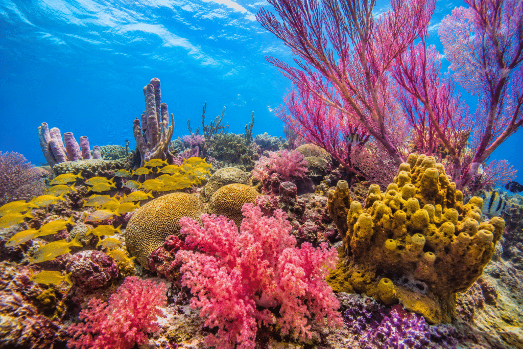
New report warns Jamaica’s south coast coral reefs and fishing grounds at risk from offshore oil exploration zones

A new report released by Earth Insight in partnership with the Jamaica Environment Trust and ten other civil society organisations around the world reveals that Jamaica’s most ecologically important marine habitats could be directly threatened by offshore oil and gas exploration in the Walton-Morant block, off the island’s south coast.
Fossil Fuel Threats to the Ocean: Marine Life and Coastal Communities at Risk draws on geospatial analysis to document how the Walton-Morant block and its associated risk zones overlap with nearly all of Jamaica’s coral reefs, seagrass beds, and the fishing grounds that coastal communities have depended on for generations. Downloadable maps for each country, including Jamaica, are available here.
The report is being released ahead of World Oceans Day (June 8) and the Our Ocean Conference, the premier global forum on ocean protection, which convenes in Mombasa, Kenya, June 16–18, 2026. The Walton-Morant block is regarded as Jamaica’s most prospective hydrocarbon asset. While the project remains at the exploration stage, Earth Insight’s geospatial analysis shows that the mapped risk zone associated with this block overlaps with 11,070 square kilometers of Ecologically or Biologically Significant Marine Areas (EBSAs)- an area roughly the size of the entire country. Within Jamaica’s Exclusive Economic Zone (EEZ), there are 60,159 km² of EBSAs in total – meaning that nearly one‑fifth (18%) of all EBSAs in Jamaica are threatened by this single block.
“Jamaica’s marine ecosystems are already under pressure from climate change, pollution, and overfishing,” said Dr. Theresa Rodriguez-Moodie, Chief Executive Officer, Jamaica Environment Trust. “While offshore activity in the Walton-Morant basin, off Jamaica’s south coast, is currently at the exploration stage, it carries the risk of opening the door to future extraction in some of our most important marine areas. Instead of pushing for oil and gas expansion, we must focus on protecting our oceans and investing in healthy ecosystems, resilient communities, and sustainable livelihoods.”

Key Findings for Jamaica:
• Earth Insight’s geospatial analysis indicates that risk zones tied to the Walton‑Morant block overlap with nearly all of Jamaica’s south coast coral reefs (99%) and seagrass areas (97%), threatening habitats that underpin fishing and tourism along the south coast.
• About 62% of marine and coastal Protected Areas (1,680 km²) and 62% of Key Biodiversity Areas (1,900 km²) fall within these mapped risk zones.
• The Walton-Morant block overlaps with 11,070 km² of EBSAs — an area roughly the size of Jamaica itself.
• The Pedro Bank — Jamaica’s primary fishing ground — along with the Pedro and Morant Cays, falls within the block’s risk zone. Oil spills, drilling discharges, or seismic surveys in or near these areas could damage habitats, disrupt fish populations, and contaminate the seafood supply chains that thousands of Jamaican households depend on.
• The Portland Bight Protected Area — a Ramsar Wetland of international importance and one of Jamaica’s largest marine protected areas — lies within the oil and gas risk zone. It is home to threatened species including the Jamaican iguana, hawksbill turtle, and American crocodile.
• South coast towns including Port Royal, Old Harbour Bay, Rocky Point, Alligator Pond, and Treasure Beach are key artisanal fishing landing sites whose livelihoods depend on the nearshore and offshore grounds now overlapped by the block’s risk zone.
• Tourism destinations along the south coast — including Hellshire Beach, Treasure Beach, and the Whitehouse coast — are vulnerable to oil pollution or coastal industrialization that could undermine both high-end resorts and community-based tourism models.
• Civil society groups, including the Jamaica Environment Trust, have questioned whether pursuing offshore oil and gas development is compatible with Jamaica’s climate commitments and its growing vulnerability as a Small Island Developing State, particularly following the devastation of Hurricane Melissa in October 2025.
The Jamaica findings are part of a broader global analysis spanning eleven case studies across Kenya, Tanzania, Cameroon, Norway, Alaska, Jamaica, Trinidad and Tobago, Argentina, Mexico, Indonesia, and Australia. The report finds that among the case studies investigated, 38% of coral reefs, 18% of seagrasses, 29% of mangroves, and 27% of marine and coastal Protected Areas fall within oil and gas risk zones, while 50% of all Important Marine Mammal Areas are directly overlapped by oil and gas blocks.
The report urges governments, financial institutions, and international bodies to:
• Stop granting new licences, permits, and approvals for offshore and coastal oil, gas, and LNG projects in or near protected areas, Key Biodiversity Areas, EBSAs, coral reefs, mangroves, and seagrass meadows;
• Establish legally binding Fossil Free Zones in areas of high ecological, cultural, and community importance;
• Align ocean protection with the 30×30 commitment to protect 30% of marine areas by 2030, and ensure that designation is backed by real restrictions on fossil fuel activity;
• Require free, prior, and informed consent of Indigenous peoples and affected communities before any licensing or permitting proceeds; and
• End public and private finance for new offshore oil, gas, and LNG expansion.
“It is alarming to see the sheer scale of fossil fuel expansion trajectories threatening the health and future of our shared ocean,” said Tyson Miller, Executive Director, Earth Insight. “Country commitments to protect 30% of the ocean by 2030 represent a unique opportunity to restrict fossil fuel blocks and concessions in order to uphold the integrity of existing and future Marine Protected Areas, whale and marine mammal corridors, and the health of coral reefs, seagrasses, and mangroves, and the communities who depend on them.”
Syndicated from Our Today · originally published .
Legal context · powered by Jurifi
Get the legal angle on this story. Pick a prompt and Jurifi's AI will explain it using Jamaican law.
AI replies are based on Jamaican law via Jurifi. Not legal advice.
Other coverage
The race for oil: will Jamaica be the next country to drill and what does that mean for its green pledges?
The Guardian (Jamaica)
Jamaica Urges Global Support for SIDS to Advance Blue Economies
Jamaica Information Service
Jamaica urges greater support for small island states at ocean summit in Japan
Jamaica Gleaner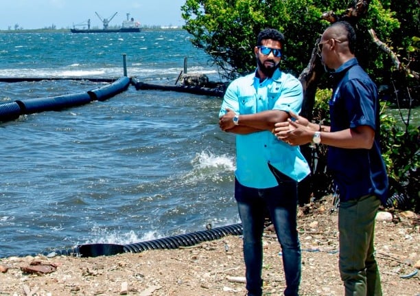
Clean Harbours Jamaica head says protecting the ocean is ‘the greatest job in the world’
Cnweekly
Treasure Bay Estates highlights investment opportunities at THROP-X 2026
Jamaica Observer