
Holness accepts 2026 Esri Presidential Award for Jamaica’s national GIS platform
Prime Minister Dr. Andrew Holness last week accepted the 2026 Esri Presidential Award on behalf of the Government of Jamaica at the Environmental Systems Research Institute User Conference in California. The honour recognised Jamaica’s integrated national geospatial infrastructure and its use of geographic information systems (GIS) to drive planning, disaster readiness, and evidence-based governance. The National Spatial Data Management Branch is now named on Esri’s wall of honorees.
Holness said he received the award for the Jamaican people, public officers, emergency responders, GIS professionals, community volunteers, international partners, and members of the diaspora present at the conference.
He stressed that GIS proved vital after Hurricane Melissa. Spatial data, he said, gave every partner a shared view of where need was highest. Dashboards tracked shelters, blocked roads, and damaged buildings in real time, while a satellite assessment classified more than 960 buildings within days. “A map is no longer just a picture on a screen. It becomes the basis on which serious life-saving decisions are made,” he said. Real-time mapping also helped the government gauge the disaster’s scale, shape decisions, and coordinate support.
That readiness, Holness argued, was built long before the storm. Jamaica’s Land Information Council dates to 1991; a national emergency-response GIS team was formed in 2009; and successive investments in training left tools in the hands of people who could use them. A whole-of-government agreement now puts a single ArcGIS platform at the service of the country, creating one common operating picture across ministries and agencies. “It was not luck. It was 30 years of preparation,” he said.
To GIS developers, trainers, and users at the conference, he urged: “Keep building. Somewhere in the world a nation, a community is counting on you the way Jamaica counted on you and you delivered.”
In an executive insights session at the same conference, Holness again framed GIS as essential to development, especially for countries such as Jamaica. He said the technology is already used in crime fighting, land titling and settlements work, forest management, and responses to severe weather. The government, he added, has woven GIS into nearly all its operations.
Pointing to coastal pressure and inherited infrastructure gaps, he said about 80 per cent of Jamaicans live near the coast while major threats—hurricanes and rising seas—arrive from the shore. Over the next century, he argued, Jamaica must lean on spatial intelligence to reorganise the country and invest heavily in GIS because “our geography is our biggest asset.”
Principal Director of the National Spatial Data Management Branch Alicia Edwards accompanied the Prime Minister. Closing the discussion, Holness advised governments adopting GIS to appoint a chief information officer for geospatial operations quickly, warning that the technology delivers little value if agencies remain siloed rather than feeding one central database.
Syndicated from Jamaica Information Service (Video) · originally published .
Legal context · powered by Jurifi
Get the legal angle on this story. Pick a prompt and Jurifi's AI will explain it using Jamaican law.
AI replies are based on Jamaican law via Jurifi. Not legal advice.
Other coverage

Prime Minister Holness to Receive 2026 Esri President’s Award; Minister Olivia Grange to Temporarily Lead Government
Ministry of Education
NLA Recognises Public, Private and International Partners
Jamaica Information Service
Local colleges need to aim for foreign students, says Troupe
Jamaica Observer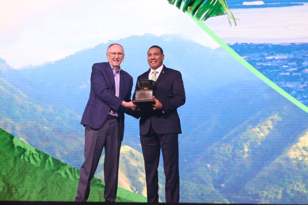
Prime Minister Holness to Receive 2026 Esri President’s Award; Minister Olivia Grange to Temporarily Lead Government
Office of the Prime Minister
No cost hikes for students amid UWI expansion plans
Jamaica Observer